
Por Julio Blanca
August 31, 2026
Technology was a key ally in supporting Venezuelans following the devastating 7.2- and 7.5-magnitude earthquakes.
Initiatives that combine artificial intelligence with data provided by citizens became ideal platforms for finding information not only when the earthquakes struck on June 24, but also in the aftermath of the tragedy.
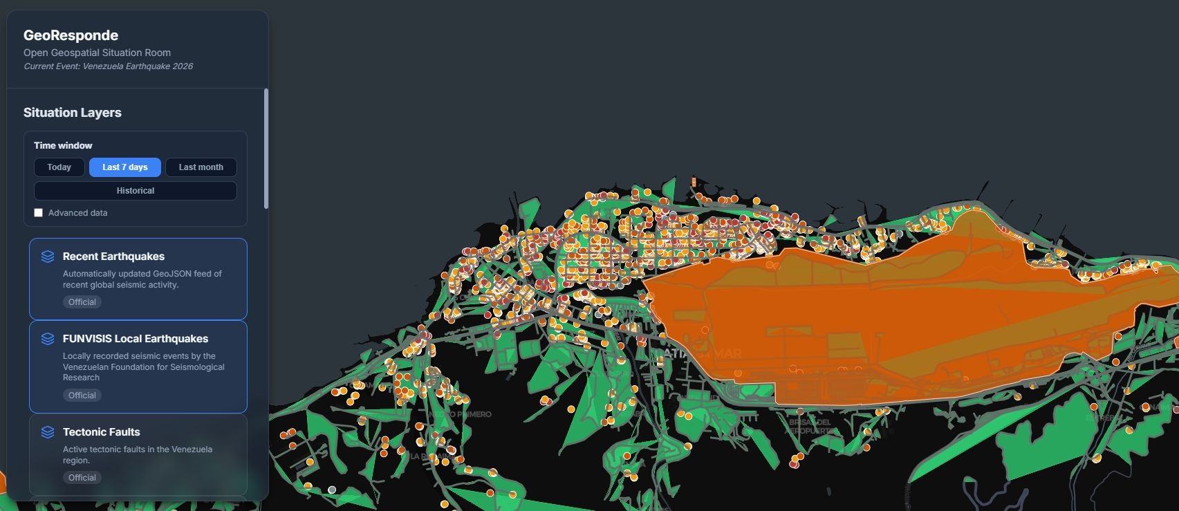
A website called GeoResponde also offered another very useful feature: a search tool for missing persons and for humanitarian aid organizations providing support to the population during these difficult times.
Daniel Arraiz, a geophysicist at the Central University of Venezuela, explained that the idea arose after seeing so much scientific and humanitarian information scattered across various sources.
Through his work, he consolidated the available data so that people could find content—such as maps of epicenters and tremors, as well as information on aid being offered from various sources to those most affected—all in one place.
"One of the things I considered when I began setting up the architecture and sharing it with people was that if we could make this actually work, we would already have the infrastructure in place to respond to any other emergency," he said.
One of the benefits of GeoResponde is that it is open-source software that has benefited from the collaboration of experts and humanitarian aid actors.
"We mapped out everything that was available—both from the scientific side, where we actually still need to gather more information, and from the humanitarian side—and we were able to identify at least 60 organizations listing collection centers, here we're compiling information from lists—for example, of missing persons in hospitals—and identifying where we need help, that is, where we need resources."
Support has also come from people outside Venezuela, who have helped improve the platform's repository and make other modifications to strengthen it.
Arraiz highlighted the contributions this technology made to the development of his project, noting that, although he had some programming knowledge, without AI he wouldn't have been able to launch it on time.
"Relying on artificial intelligence to build things was, let's say, absolutely essential. There's no other word to describe it—I mean, I wouldn't have been able to have it ready in three or four days if it hadn't been for Antigravity," he said.
Arraiz understands that, although technology can be transformative, there is another elements that is also indispensable: knowledge. Both to understand the reality of the disaster and to be prepared for crisis situations.
"Another reason that really motivated me is trying to contribute, in one way or another, with knowledge. Again, I'm no expert in seismology, but I'm well-versed in the numbers and fully understand what it's all about and how to interpret the map. And there are many well-meaning people, but using artificial intelligence makes it so easy to produce something that they started generating too much misinformation," he said.
The specialist added that for years there had been discussions about soil studies and risks in the seismic zones of Caracas and La Guaira. However, he believes that preventive measures were not as thorough as they should have been.
"There is a vast body of work that identified which areas are seismic zones, and it's a shame that this knowledge—though I'm not looking to blame those who conducted the research—never reached where it was supposed to go, all the way to where it was supposed to go, because knowledge about prevention is fundamental," he emphasized.
Finally, Arraiz explained his vision for the future of GeoResponde, a website through which he would like to establish a partnership with the Venezuelan Society of Geophysicists and other members of the geophysics community.
"From a scientific standpoint, we'd like to try to build on the work that's already been done here, compile more of the existing scientific information and the new data that's coming—since there are people working on generating new information— to study maps and new findings to turn it into a repository for preserving the scientific legacy of what happened during the 2026 Venezuela earthquake. What does this mean? That in 10 years, someone might be able to find everything they need about the earthquake in one place."



